In 2017, we were delighted to collaborate with the National Library of Wales and RCAHMW to co-host Carto-Cymru: The Wales Map Symposium.
The annual event, organised by Huw Thomas, Map Curator at the National Library of Wales, is designed to enhance public and academic appreciation of the richness of Wales’s cartographic heritage.
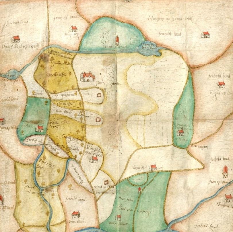
The 2017 event focused on estate maps, exploring the development of estate mapping and its value in presenting the historical landscape.
The symposium included a presentation by Dr. Shaun Evans, outlining how estate maps represent an important source for understanding the socio-cultural history of estates and estate landscapes in Wales, as well as the following contributions:
- Peter Barber, former Head of Maps, British Library - Estate Maps and the Image of the Landowner 1570-1800.
- Dr Bob Silvester, Visiting Professor, Chester University - Changing trends in estate mapping in the Welsh border counties during the seventeenth and eighteenth centuries.
- Dr Jacinta Prunty, Head of History, Maynooth University, Map-making and estate management: urban case studies drawn from the Irish Historic Towns Atlas.
- John Dollery and Scott Lloyd, RCAHMW – Cantrefi a Cymydau: rediscovering the medieval boundaries of Wales for the digital age.
- Dr Sarah Bendall, Fellow, Emmanuel College, Cambridge – Land-owning bodies and their estates: maps and map-makers for institutions.
- Einion Gruffudd, Cynefin Project Manager, National Library of Wales – Digido mapiau degwm a stadau i bobl Cymru / Digitising tithe and estate maps for the people of Wales.
- Huw Thomas, Map Curator, National Library of Wales – The survey of the Manors of Crickhowell and Tretower, 1587, by Robert Johnson.
See a selection of estate maps digitised by the National Library of Wales.
Following the symposium, Dr. Shaun Evans was invited to contribute a series of blogs based on estate maps held by the National Library of Wales.
- ‘Welsh estate maps: 1: Property, Place and Power’.
- ‘Welsh estate maps 2: A 17th century map of Whitlera, Carmarthenshire’.
- ‘Welsh estate maps 3: What happens at the boundaries of estates?’.
- ‘Welsh estate maps 4: Trees and woodlands’.
The symposium provided a foundation for enhanced collaboration between ISWE, RCAHMW and the National Library of Wales, providing part of the underpinning for our AHRC-funded ‘Deep Mapping Estate Archives Project’.
Estate maps represent an important focus for ISWE’s research and we are keen to work with archives across Wales and beyond to make these resources more accessible via digitisation.